
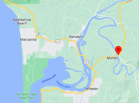
Located in the northern part of Tillamook County, the towns of Nehalem, Manzanita, and Wheeler are just a few miles apart, situated around Nehalem Bay along the Oregon Coast Highway. Nehalem and Wheeler sit slightly inland on the Nehalem River; Manzanita is on the coast.

Nehalem, Oregon
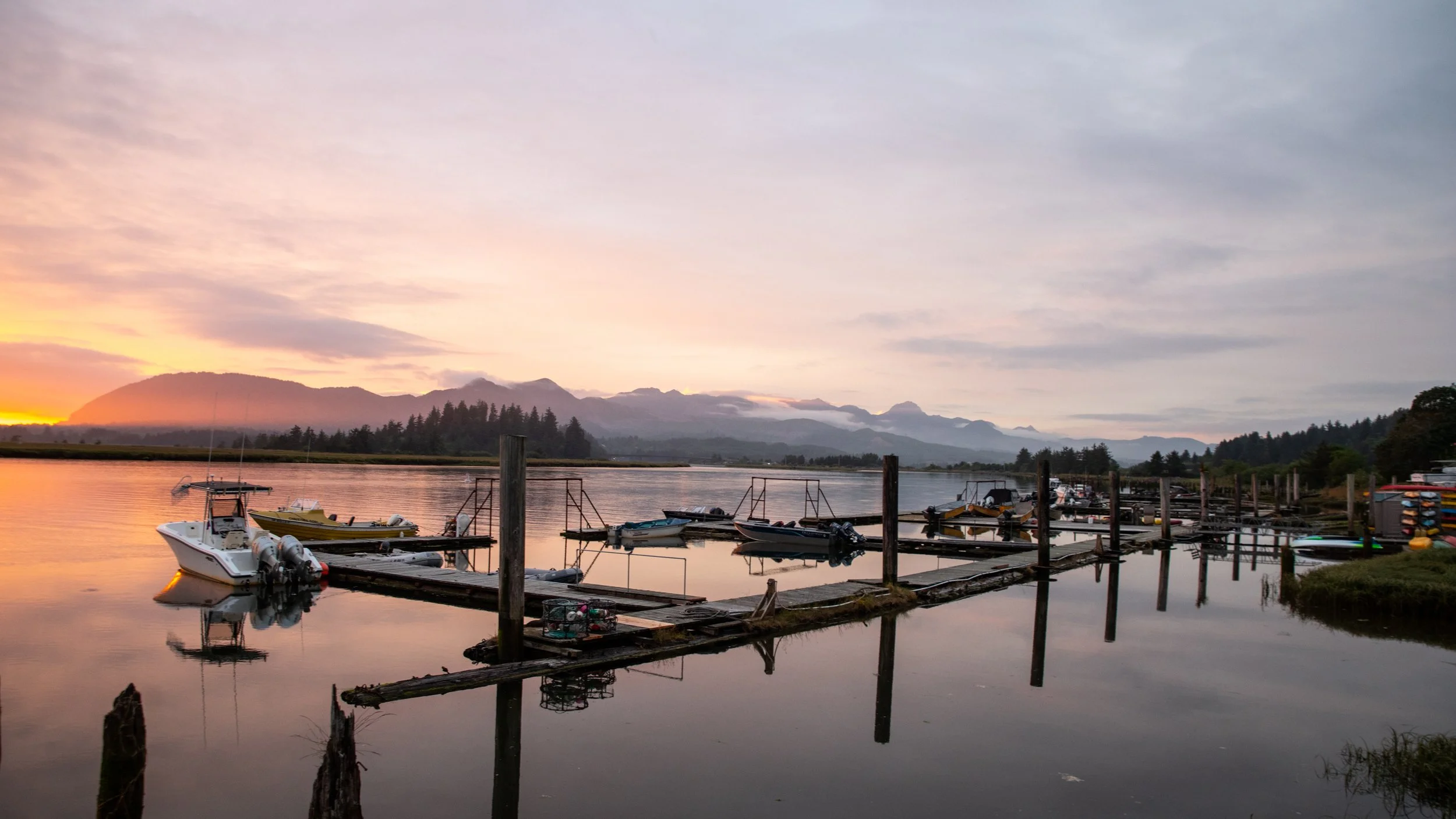
The Nehalem River Inn is located less than three miles from Nehalem, a small village with a population of around 300. Located 90 minutes west of Portland, Nehalem is nestled along the Nehalem River, a small coastal river that rises in the mountains, then flows southwesterly across the northern part of Tillamook County to the Pacific.
Less than three miles from Nehalem Bay State Park, one of the state's most popular camping and trail destinations, Nehalem was incorporated in 1899 as the logging and fishing industries expanded along the coast.

Manzanita, Oregon
“Manzanita is a secluded and gorgeously
situated seaside community…” — Fodor’s
Just two miles north of Nehalem is Manzanita, a small, charming village that’s home to some 700 residents.
The center of the commercial district is approximately four blocks from the ocean on the road that runs from the beach to Highway 101 at mile 43 (43 miles from Astoria).
The word "Manzanita" means “little apple” in Spanish, and the town is named for the trees and bushes that grow in the area.
Manzanita lies at the foot of 1,631 foot high Neah-kah-nie Mountain, the second highest point on the Oregon Coast.

Wheeler, Oregon
“A charming, historic waterfront village whose buildings are strung together on the edge of a beautiful bay, with what some call some of the loveliest views in all Oregon.” — Coast Oregon
Located just two miles south of The Nehalem River Inn on the Oregon Coast Highway (Hwy 101), Wheeler is a former logging town that is known today for its antique shops and the Oregon Coast Railriders, a four-seater, pedal-powered railroad bicycle running along an inactive portion of the Port of Tillamook Bay Rail Road.